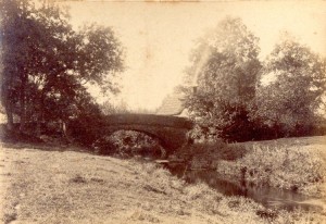
Unknown Bridge
Do you know where this bridge is? The image is undated and we have no notes about it. If you have any information about it, perhaps you could leave a comment or send us an email.
Bring the past to the present
Unknown Bridge
Do you know where this bridge is? The image is undated and we have no notes about it. If you have any information about it, perhaps you could leave a comment or send us an email.
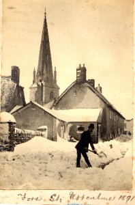
Fore St., Uffculme. 1891.
Clearing the snow in Fore Street, Uffculme. This image from 1891 was taken at the top of Kents Close, just outside number 10, Fore Street. St. Mary’s Church and Uffculme Square are the other side of the houses.
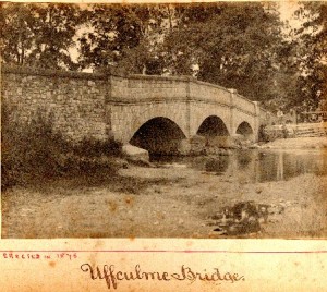
Uffculme Bridge
Uffculme Bridge was erected in 1875. This picture shows three men standing on the opposite bank. There is no indication of who they might be. The picture is currently undated.
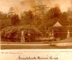
At the pond, Craddock House
The picture features Mrs New and her family at the pond, at Craddock House. We’d be very keen to hear from the New family or anyone who has any information they can add to the archives, about this picture.
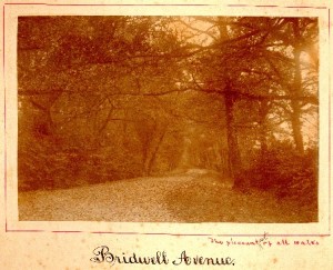
Bridwell Avenue
Little has changed in this scene, over the years.
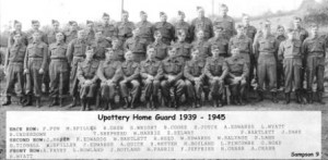
The men of Upottery Home Guard
The picture shows 37 members of the Upottery Home guard (1935-1945)
Back row: F. Pym, M. Spiller, Richard Drew, Stanley Wright (Stanley Arthur William Wright born 1921 in Kilmington moved to Highley Farm, Upottery in 1931), Bert Cooke, Ern Joyce, A. Edwards, Len Wyatt, Reg Underdown, Tom Shepherd, Will Harris, Ed Selway, F. Bartlett and Jack Dare.
Second row: J. Baker, R. Edwards, William Bartlett, Cpl. Raymond Reed, W. Edwards, W. Salvage, Stanley Lane, B. Tidball, ? Spiller, J. Edwards, Arthur Quick, S. Retter, Henry Boyland, L. Pincombe and George Bond.
Front row (seated): Cpl. Alf Pavey, Cpl. Les Rowland, Sgt. J. Boyland, (Officer, rank unknown) W. Parris, (Officer, rank unknown but appears to be Lt.) F. Jefferies, Sgt. H. Crabb, Sgt. A. Crabb and Sgt. R. Wyatt.
Can you help with first names?
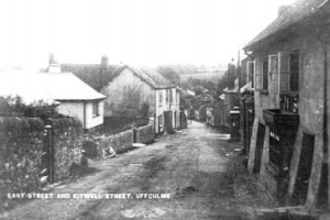
The old Baker’s shop at No. 6 East Street on the immediate right
Taken in the show of the Mill, at High Street. This picture looks south-east, down East Street, towards Kitwell Street, Uffculme.
On the immediate right of the shot, is the old baker’s, owned by Mr Richards, at number 6 East Street – now a private home.
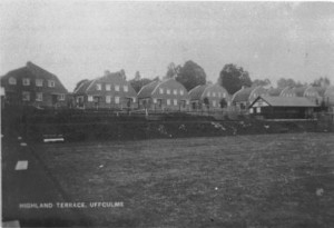
Highland Terrace, Uffculme, taken from Commercial Road.
The houses stand above the bowling green on what is now the childrens’ play park and should give a clue to the date of this picture. From comments to this web site from local residents we are gradually improving the information abut photos.
Taken from Commercial Road and facing North-North-West, these houses have now been demolished in 1980 and relaced by new houses and roads. Google Street View.

Heading south, down Coldharbour, just after Grantlands.
With your back to Commercial Road (B3440), this shot looks down Coldharbour, heading south. Grantlands would be back over your left shoulder.
The tree on the right has long gone and parking is a little more of a challenge, these days!
Please tell us what you know about this scene?